

Due to the nature of our trail runs and needing the ability to monitor how many to expect, we are moving to our Facebook Group page where we will post all group trail runs
We may publish special events here in the future.
We know that not everyone uses Facebook, but in the interest of safety and understanding how many people to expect on the trails we’ve made the decision to offer our events exclusively through the group. Just join the group and you will see all you need!


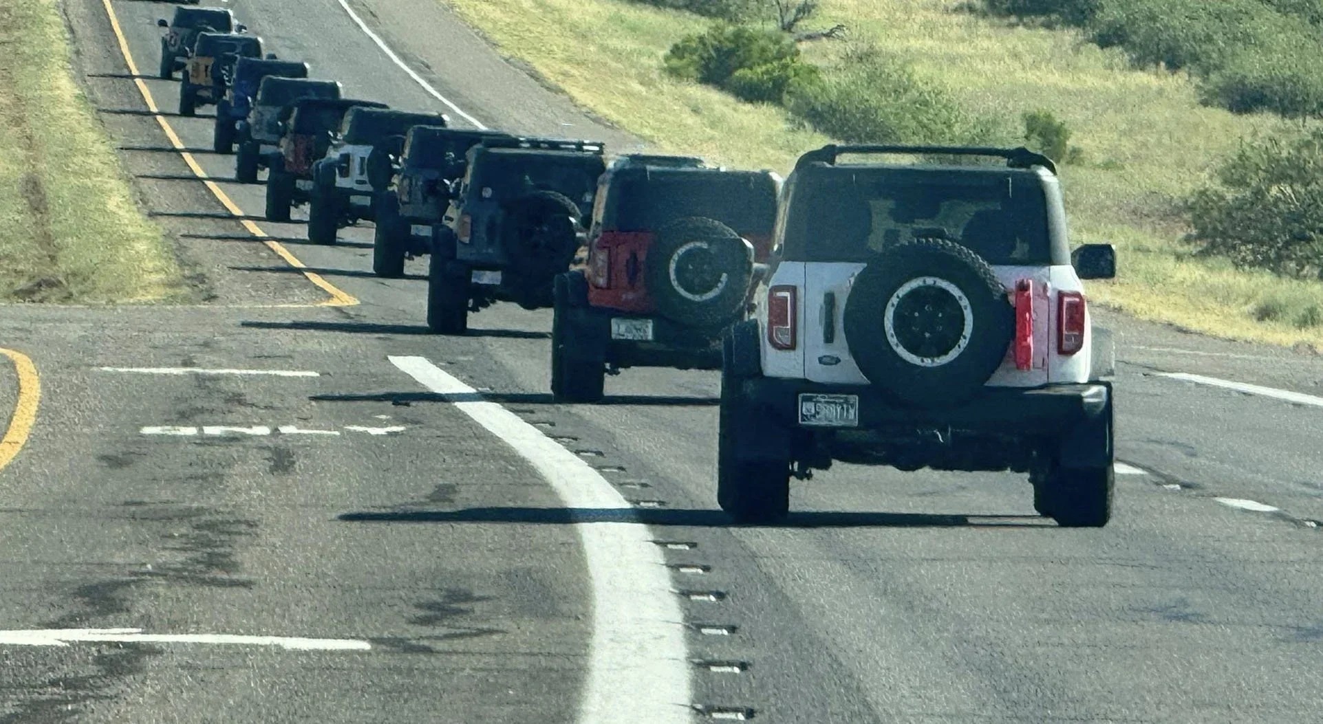
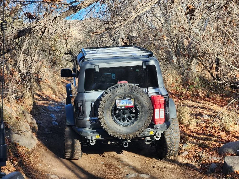
Box Canyon Florence - Advanced Run
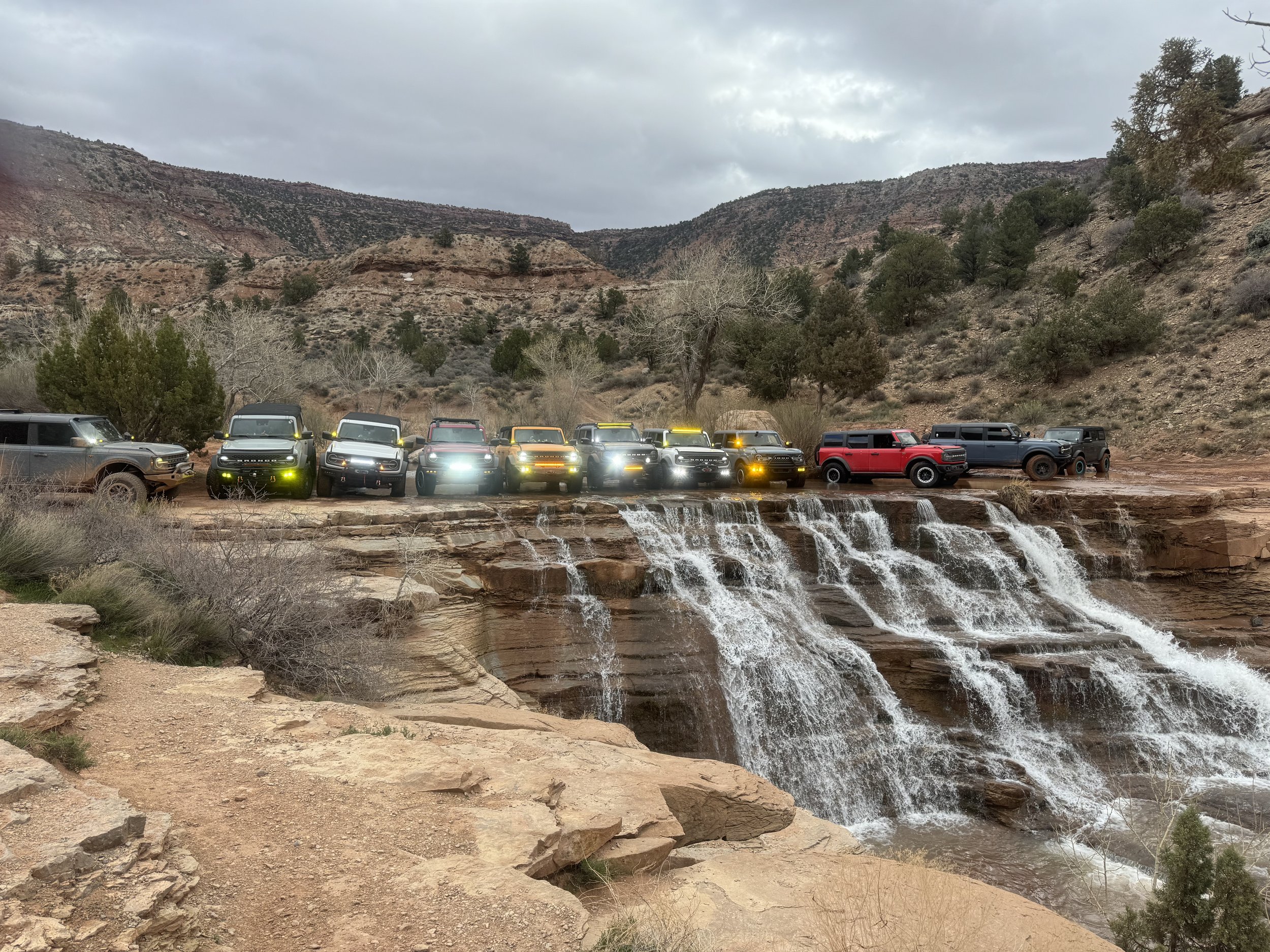
Box Canyon Florence - Cottonwood Canyon - Advanced Run with Waterfall!
Weather kept us away after San Tan Ford Customs Bronctoberfest - But we couldn't let these runs go! Here's the Advanced Run!
Meetup Time: 9:30AM - Roll from Speedway at 9:45AM
Trail time (estimated): +/- 5 hours on dirt
Meetup: Speedway (By McDonalds) Florence https://maps.app.goo.gl/ntu6E9oCg9jgSusYA
rail Difficulty Level: Intermediate
Permit Required: YES – Arizona State Trust Land Permit Required https://azland.my.salesforce-sites.com/recreationalpermit/
We are starting to wrap up the charity drive (Thank GOD!) with a big weekend in Florence! TWO RUNS!
We are running two routes together. This is the Intermediate Route.
Both groups will roll out together through Box Canyon until the Mineral Mountain waterfall turnoff. From there, we will make the right turn up to the Waterfall obstacle and then decide if we’re going to do the Rollercoaster or continue through the lower ledge section. Either way is a blast! We will continue on and meet the other group at 5 Points and head out together as a group through Cottonwood Canyon.
This is an advanced trail that you will want a MINIMUM of 33” Tires and a rear locker to conquer. (We suggest 35’s and both Front and Rear lockers) This is not a first timer trail, but a great trail to move to the next level of difficulty.
As always…. On ANY trail in Arizona there is an inherent risk of Arizona pin stripes or scrapes/scratches. The Arizona Broncos group and San Tan Ford does not take any responsibility for any damage or injury that may happen along the trail.
THE BASICS AND WHAT TO BRING
Nobody left behind… EVER! - Pack it in, Pack it out.
Arizona State Trust Land Permit
GMRS Radio (We will pick the channel when we air down). PLEASE, make sure you know how to use your radio before we go!
More water and drinks than you think you will need
Bring a snack if you like and chairs for when/if we break
Full tank of fuel
Air down kit and compressor
First aid Kit
Your normal “off-road” kit as you see fit
CHARITY DRIVE DETAILS: At every trailhead through the season—you’ll have a chance to give back. For those who are able, we’re collecting new, unwrapped toys, children’s clothing, and cash donations at all group events. (Our target is a gift worth approximately $10.00.) Donations are not required but are greatly appreciated!
As a thank you, you’ll receive a raffle ticket for our Christmas Party & Raffle on December 14th (you do not need to be present to win). Expect some incredible prizes at the raffle! 100% of donations will go directly to the organizations we’re supporting this year.
Box Canyon Florence - Moderate Run
Box Canyon Florence - Cottonwood Canyon - Moderate Run - No Waterfall
Box Canyon Florence - Cottonwood Canyon - Moderate Route (No Waterfall)
Weather kept us away after San Tan Ford Customs Bronctoberfest - But we couldn't let these runs go! Here's the Intermediate Run!
Meetup Time: 9:30AM - Roll from Speedway at 9:45AM
Trail time (estimated): +/- 5 hours on dirt
Meetup: Speedway (By McDonalds) Florence https://maps.app.goo.gl/ntu6E9oCg9jgSusYA
rail Difficulty Level: Intermediate
Permit Required: YES – Arizona State Trust Land Permit Required https://azland.my.salesforce-sites.com/recreationalpermit/
We are starting to wrap up the charity drive (Thank GOD!) with a big weekend in Florence! TWO RUNS!
We are running two routes together. This is the Intermediate Route.
Both groups will roll out together through Box Canyon until the Mineral Mountain waterfall turnoff. From there, we’ll continue straight and bypass the waterfall, traveling over some great hills to 5 Points before finishing the route through Cottonwood Canyon into Florence.
This is a moderate to intermediate trail that any Bronco with an experienced driver can handle with confidence. The ride is bumpy in sections, so you will want to air down down your tires at the trail head. This is not a first timer trail, but a great trail to move to the next level if you’ve been getting your off-road wheels underneath you.
As always…. On ANY trail in Arizona there is an inherent risk of Arizona pin stripes or scrapes/scratches. The Arizona Broncos group and San Tan Ford does not take any responsibility for any damage or injury that may happen along the trail.
THE BASICS AND WHAT TO BRING
Nobody left behind… EVER! - Pack it in, Pack it out.
Arizona State Trust Land Permit
GMRS Radio (We will pick the channel when we air down). PLEASE, make sure you know how to use your radio before we go!
More water and drinks than you think you will need
Bring a snack if you like and chairs for when/if we break
Full tank of fuel
Air down kit and compressor
First aid Kit
Your normal “off-road” kit as you see fit
CHARITY DRIVE DETAILS: At every trailhead through the season—you’ll have a chance to give back. For those who are able, we’re collecting new, unwrapped toys, children’s clothing, and cash donations at all group events. (Our target is a gift worth approximately $10.00.) Donations are not required but are greatly appreciated!
As a thank you, you’ll receive a raffle ticket for our Christmas Party & Raffle on December 14th (you do not need to be present to win). Expect some incredible prizes at the raffle! 100% of donations will go directly to the organizations we’re supporting this year.
Ripsey Mine - Moderate Trail
Ripsey Mine - Great trail with a fun river crossing at the end!
• Date: Saturday November 22th
• Meet up time: 10:00 AM – Roll towards trail at 10:15 (Air Down / Driver Meeting and on trail by 10:45AM)
• Trail Time (ESTIMATED): +/- 4 hours on dirt depending on number of rigs.
• Meet up Coordinates: 32.98868, -111.11647 (Boulders staging area off Kelvin Florence Road)
• Google Maps Link: https://maps.app.goo.gl/VpwzDK19GBfpfqVT8
• Permit Required: YES https://azland.my.salesforce-sites.com/recreationalpermit/
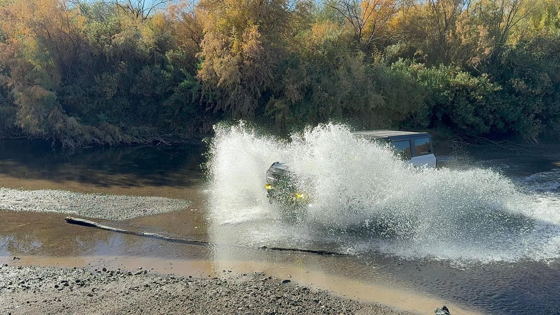
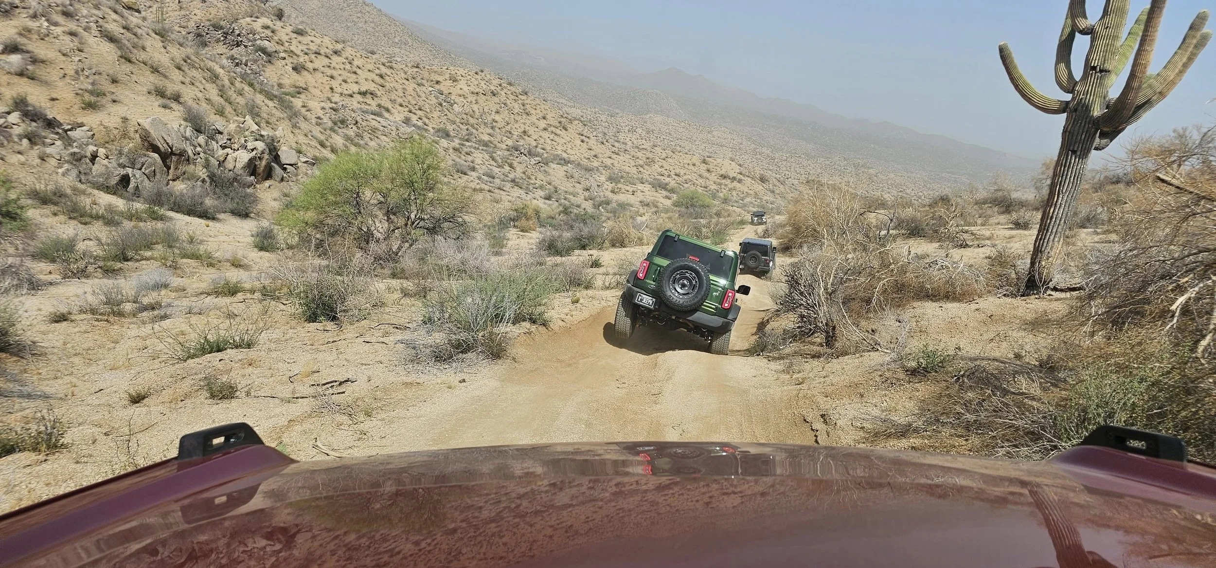
Get ready for an exciting day exploring. Ripsey Wash, Ripsey Mine, Florence Lead-Silver Mine, and Hackberry Mine are all within a relatively small area packed with history and great scenery. This trail offers plenty of variety and even includes a fun river crossing!
The trail itself isn’t difficult overall, but there is one steep, narrow descent just after the mine. We’ll stop at the mine for lunch — it’s a fascinating spot to explore if you’re feeling adventurous. Be sure to bring a flashlight or headlamp if you plan to venture inside!
Any Bronco or high clearance 4x4 configuration can tackle this trail without issue, but due to the river crossing, it’s not Bronco Sport friendly. One of the best parts of the day will be the Gila River crossing at Kearney — always a highlight! I’ve run this many times and have yet to see it impassable.
We’ll meet at The Boulders OHV Area just outside Florence to air down and prep for the trail. It’s about a 12-mile drive from there to the trailhead. You can air down at The Boulders or wait until we reach the trailhead — your choice.
Should be an awesome day out!
You'll need a Arizona State Trust Land permit which can be purchased at the link:
https://azland.my.salesforce-sites.com/recreationalpermit/
If you currently have a permit, check the expiration date to ensure you are current.
As always…. On ANY trail in Arizona there is an inherent risk of Arizona pin stripes or scrapes/scratches. The Arizona Broncos group does not take any responsibility for any damage that may happen along the trail.
The Basics and What to Bring
• Nobody left behind… EVER!
• Pack it in, Pack it out.
• GMRS Radio (We will pick the channel when we air down). PLEASE, make sure you know how to use your radio before we go!
• More water and drinks than you think you will need
• Bring a lunch and chairs for when we break
• Full tank of fuel
• We will air down so bring your compressor!
• Your normal “off-road” kit.
CHARITY DRIVE DETAILS: At every trailhead through the season—you’ll have a chance to give back. For those who are able, we’re collecting new, unwrapped toys, children’s clothing, and cash donations at all group events. (Our target is a gift worth approximately $10.00.) Donations are not required but are greatly appreciated!
As a thank you, you’ll receive a raffle ticket for our Christmas Party & Raffle on December 14th (you do not need to be present to win). Expect some incredible prizes at the raffle! 100% of donations will go directly to the organizations we’re supporting this year.
Telegraph Line Trail - A group favorite!
Telegraph Line Trail - A group favorite!
• Meet up time: 10:00 AM – Roll out no later than 11:00
• Trail Time (ESTIMATED): +/- 4 hours on dirt depending on number of rigs.
• Meet up Coordinates: 33.84527, -111.6481 (Tonto Parking Site just off Bartlett Dam Road)
• https://maps.app.goo.gl/ZitWLGLrFby5YEfW8
• Trail Type: Moderate
• Permit is required for this event – See details below
We’re offering another chance to donate to our Charity Drive and get more raffle tickets on this run! See below for details
Telegraph Line Trail also known as Trail FR42 is a moderate trail that will test your skills if you are newer to the trails but this is NOT a newbie trail for first timers.
Telegraph Line is a 13.4-mile point-to-point trail that runs one-way only, starting just off Bartlett Dam Road and ending at Horseshoe Lake Road near Horseshoe Dam. The route features a mix of dirt, decomposed granite, and sandy terrain, making for an engaging off-road experience.
Along the way, we will encounter seven named obstacles:
• The Gatekeeper
• Nosedive
• Ben’s Big Rut
• Samurai Turn
• Airplane
• Edge of the Earth
• Mini Edge of the Earth
In addition to these, the trail offers a variety of other fun and challenging features that make it a favorite for many. We’ll plan to stop at the lake for lunch and a chance to cool off—don’t forget to pack snacks and water!
A 3 day permit is $10, a 6 month is $60 and an annual pass is $80. Be sure to purchase your pass before to head out and print a copy to show rangers if you are stopped. Click the link here to get your permit https://www.recreation.gov/activitypass/AP22844
Vehicle Requirements:
Any Bronco on 35” tires will have no issues on this trail. If you are on 33’s you might get a little scraping here and there
THE BASICS AND WHAT TO BRING
• Nobody left behind… EVER!
• Pack it in, Pack it out.
• GMRS Radio (We will pick the channel when we air down). PLEASE, make sure you know how to use your radio before we go!
• More water and drinks than you think you will need
• Bring a snack if you like and chairs for when/if we break
• Full tank of fuel
• Air down kit and compressor
• First aid Kit
• Your normal “off-road” kit as you see fit
Reminder: There is always a risk of Arizona pinstripes or body damage, especially on a trail like this! Run at your own risk — AZ Broncos is not responsible for vehicle damage.
CHARITY DRIVE DETAILS: At every trailhead through the season—you’ll have a chance to give back. For those who are able, we’re collecting new, unwrapped toys, children’s clothing, and cash donations at all group events. (Our target is a gift worth approximately $10.00.) Donations are greatly appreciated, and 100 percent will go to charity!
As a thank you, you’ll receive a raffle ticket for our Christmas Party & Raffle on December 14th (you do not need to be present to win). Expect some incredible prizes at the raffle!
100% of donations will go directly to the organizations we’re supporting this year.

Vulture Mine - Following Bronco Roundup
Vulture Mine (Lite) Loop Following The Arizona Bronco Roundup!
• Date: Saturday November 15
• Meet up time: 1:00 PM at Sanderson Ford - Roll out at 1:30 PM Immediately following the event.
• Trail Time (ESTIMATED): +/- 3 hours on dirt depending on number of rigs.
• Meet up Spot : Sanderson Ford 6400 N 51st Ave
Glendale AZ 85301
• Google Maps: https://maps.app.goo.gl/rXwJ6r3VwNbyuwqe8
• Trail Type: Easy
• Permit Required: YES - Arizona State Trust Land Permit
• https://azland.my.salesforce-sites.com/recreationalpermit/
We will caravan (As best we can) to the trailhead directly from Sanderson Ford.
This is a great, easy fun run! We will run only the lower, less challenging loop of the trail. Immediately following the Arizona Bronco Roundup.
Located just outside of Morristown, the trail is convenient for the west-side crowd as well! The route offers plenty of scenic views with Teddy Bear Cholla cactus and wide-open desert landscapes and some old mine shafts here and there.
While mostly mild, there are a couple of short sections that lean toward the “technical” side—but nothing that any Bronco can’t handle.
We’ll be running lower loop of the trail. Along the way, you’ll encounter old mines and ruins that make this run both fun and unique. Please come prepared with plenty of water and supplies, as this trail doesn’t see much regular use.
THE BASICS AND WHAT TO BRING
• Nobody left behind… EVER!
• Permit Required: YES - Arizona State Trust Land Permit
• https://azland.my.salesforce-sites.com/recreationalpermit/
• Pack it in, Pack it out.
• GMRS Radio (We will pick the channel when we air down). PLEASE, make sure you know how to use your radio before we go!
• More water and drinks than you think you will need
• Bring a lunch and chairs for when we break
• Full tank of fuel
• Air down kit and compressor (If you don’t have one, we can help)
• First aid Kit
• Your normal “off-road” kit as you see fit
Reminder: There is always a risk of Arizona pinstripes or body damage, especially on a trail like this! Run at your own risk — AZ Broncos, Sanderson Ford and the Arizona Broncos Roundup is not responsible for vehicle damage.
See less

Bulldog Canyon - Sponsored by BULLDOG WINCH
Bulldog Canyon - Charity Drive Run
Sponsored by Bulldog Winch and Desert Rat!
Date: Saturday November 8th (Immediately following Desert Rat Coffee and Crawlers)
Meet up time: 11:00 AM (Air Down / Driver Meeting and on trail by 11:30AM)
Trail Time (ESTIMATED): +/- 4 hours depending on number of rigs.
Meet up Coordinates: 33.50483, -111.61777 (Bulldog Canyon OHV staging area off Usery Pass Road)
Google Maps Link: https://maps.app.goo.gl/7UWsB3AEBT3EiyXy8
Directions from Desert Rat Tempe: https://maps.app.goo.gl/sBT1nRxWcJm8izqg7
Immediately following Coffee and Crawlers at Desert Rat in Tempe, we will be running the Bulldog Canyon OHV trail from Usery Pass through to Lost Dutchman (with the option to exit at Apache Junction if you are short on time). This route takes us along FR3554 down through the wash and then we turn at the end of the wash to FR 10 towards Apachee Junction (where you can choose to exit if you are short on time), the rest of the group will continue on to FR1356 to the Lost Dutchman Gate on SR88.
There are a couple obstacles and a rocky section on this trail but for the most part it is a fairly tame trail to do with the group!
For this trail you WILL need a Tonto OHV permit. Current cost is $10 for a 3 day permit, $60 for a 6 month Permit and $80 for an annual permit. for a 6 month permit. Purchase online here: https://www.recreation.gov/activitypass/AP22844. This permit gets you in to all of the Tonto OHV areas (Bulldog, Rolls OHV, Desert Vista and St. Clair).
Please do not try to hop on the run without a permit as the Forest Service is enforcing and checking for permits.
Any Sasquatch Bronco or Bronco on 33” or larger tires and a driver who has been off road a few times should be able to run this trail without any major issues. You will rub more with tires smaller than 33”.
The Basics and What to Bring
Nobody left behind… EVER!
Pack it in, Pack it out.
GMRS Radio (We will pick the channel when we air down). PLEASE, make sure you know how to use your radio before we go!
More water and drinks than you think you will need
Bring a lunch and chairs for when we break
Full tank of fuel
We will air down so bring your compressor!
Your normal “off-road” kit.
CHARITY DRIVE DETAILS: At every trailhead through the season—you’ll have a chance to give back. For those who are able, we’re collecting new, unwrapped toys, children’s clothing, and cash donations at all group events. (Our target is a gift worth approximately $10.00.) Donations are not required but are greatly appreciated! All toys collected on this run will go to the Desert Rat Coffee and Crawlers Christmas Event Donation Drive!
As a thank you, you’ll receive a raffle ticket for our Christmas Party & Raffle on December 14th (you do not need to be present to win). Expect some incredible prizes at the raffle! 100% of donations will go directly to the organizations we’re supporting this year.
Night run at Sycamore!
Friday Night Lights and star gazing!
DATE: Friday November 7th
Meet up time: 6:30 PM (Air Down / Driver Meeting and on trail by 7:00PM)
Trail Time (ESTIMATED): 3-4 hours depending on number of rigs.
Meet up Coordinates: 33.62876, -111.56069 (Staging area on the north side of the Beeline Highway where it meets Bush Highway)
Google Maps Link: https://maps.app.goo.gl/Qrd1ZVcJ1rv1kRkG9
We are continuing our Charity Drive push with the scenic way around Sycamore up over the hill to the viewpoint overlooking Fountain hills. We can’t promise it, but there is a good chance this time of year that we might have some water in the wash!
We’ll meet up at the “Keyhole” where Bush Highway and The Beeline Highway meet up, air down and head out. We’ll go up the hill by the Quartz Mine, pass it and continue up high to the viewpoint for a break and chance to look at the stars. From there we’ll head back down towards the wash and on out!
This trail has a few challenges and narrow spots. Great climbs and descents as well. Not a newbie trail and we recommend that you have a Bronco on 33” tires, if not, be prepared for some skid scraping for sure.
As always…. On ANY trail in Arizona there is an inherent risk of Arizona pin stripes or scrapes/scratches. The Arizona Broncos group does not take any responsibility for any damage that may happen along the trail.
The Basics and What to Bring
Nobody left behind… EVER!
Pack it in, Pack it out.
GMRS Radio (We will pick the channel when we air down). PLEASE, make sure you know how to use your radio before we go!
More water and drinks than you think you will need
Bring a lunch and chairs for when we break
Full tank of fuel
We will air down so bring your compressor!
Your normal “off-road” kit.
CHARITY DRIVE DETAILS: At every trailhead through the season—you’ll have a chance to give back. For those who are able, we’re collecting new, unwrapped toys, children’s clothing, and cash donations at all group events. (Our target is a gift worth approximately $10.00.) Donations are not required but are greatly appreciated!
As a thank you, you’ll receive a raffle ticket for our Christmas Party & Raffle on December 14th (you do not need to be present to win). Expect some incredible prizes at the raffle! 100% of donations will go directly to the organizations we’re supporting this year.

Walnut Canyon (Superior) Moderate - Difficult Trail
Meet up time: 9:00 AM (We will leave the gas station for the trailhead at 9:15AM)
Trail Time (ESTIMATED): +/- 6 hours on dirt depending on number of rigs.
Meet up Coordinates: 33.28555, -111.11502 (Circle K Superior)
Trail Head Coordinates: 33.17741, -111.03994
Trail Type: Moderate-Low Difficult in spots
Leaders: Graham Taylor and Steve Neiman
Yup - It's another CHARITY DRIVE Run! (Details Below)
We will meet at the Circle K in Superior where the GAS IS CHEAP! We will top off and head to the trailhead as a group. The trailhead is a 15-20 minute drive from the gas station.
Though we’ve run this trail many times, there are spots that change with weather, erosion and use. (After this fall's rains, you never know exactly what to expect)! You will get to experience some long climbs and descents, a lunch near the river and an all around great time!
This trail is NOT recommended for a Rig with less than 33" tires (35's are preferred), there will be spots where you scrape but can still do the trail with 33's. A rear locker is also a necessity here. This is a really fun trail with a little bit of everything.
As always…. On ANY trail in Arizona there is an inherent risk of Arizona pin stripes or scrapes/scratches. The Arizona Broncos group does not take any responsibility for any damage that may happen along the trail.
The Basics and what to bring.
Nobody left behind… EVER!
Pack it in, Pack it out.
GMRS Radio (We will pick the channel when we air down). PLEASE, make sure you know how to use your radio before we go!
More water and drinks than you think you will need
Bring a lunch and chairs for when we break
Full tank of fuel
We will air down but if you don’t have a compressor, we can help out.
Your normal “off-road” kit.
Please – No drugs or alcohol on the trail.
CHARITY DRIVE DETAILS: At every trailhead through the season—you’ll have a chance to give back. For those who are able, we’re collecting new, unwrapped toys, children’s clothing, and cash donations at all group events. (Our target is a gift worth approximately $10.00.) Donations are not required but are greatly appreciated!
As a thank you, you’ll receive a raffle ticket for our Christmas Party & Raffle on December 14th (you do not need to be present to win). Expect some incredible prizes at the raffle! 100% of donations will go directly to the organizations we’re supporting this year.
Arizona Broncos Poker Run 2025
Arizona Broncos Inaugural Poker Run and Street Cruise 2025
You have asked for it, so we are giving it to you, the Arizona Broncos version of a street cruise mixed with a poker run! All proceeds will go directly toward our Season of Giving Campaign and the charities we are supporting.
What: Arizona Broncos 1st Annual Poker Run for the Season of Giving
When: Saturday, October 25th, 2025. 9:00am-1:30pm
Where: We’ll meet at San Tan Ford (1429 E Motorplex Loop, Gilbert, AZ 85297) and pull into the designated parking location
Concept of the Operation: We will meet at San Tan Ford starting at 9am.We will park in the designated location and prior to our departure, will take a group photo.During that time, anyone who hasn’t already registered for the Poker Run can do so.Cards will also be distributed during this time to the participants.At 10am, we will depart as a group and cruise to our next location.The final location will be The Hudson Eatery - 1601 East Apache Boulevard, Tempe, Arizona 85281.They will be offering some great food and drink specials for our members!
If you would rather not take part in the Poker Run, you can still come along for the street cruise.As with all group sanctioned runs, for those who are able, we’re collecting new, unwrapped toys, children’s clothing, and cash donations. (Our target is a gift worth approximately $10.00.) Donations are not required but are greatly appreciated!
As a thank you, you’ll receive a raffle ticket for our Christmas Party & Raffle on December 14th (you do not need to be present to win).
Prize Awards: 1:30 pm
Prize: 50% of registration fees. Example: We raise $2000, winner gets $1000. Additional prizes may be awarded.
Payment and Registration right here!
Donations/Costs:
Registration Fee $50 per player (Each registration will receive 5 tickets to the EOY raffle)
Option to buy two bonus cards for $10 each (Each purchase will receive 1 ticket to the EOY raffle)
Participants must be present to win.
Card Locations:
San Tan Ford - 1429 E Motorplex Loop, Gilbert, AZ 85297
DV8 Off-Road / Addictive Desert Designs - 555 E Queen Creek Rd #A, Chandler AZ 85286
Motley Industries Tools - 6142 W. Detroit St., Chandler, AZ 85226
Doetsch Off-Road - 480 E Warner Rd, Suite 2, Chandler, AZ 85225
The Hudson (Sponsored by Bulldog Winch) - 1601 E Apache Blvd, Tempe, AZ 85281-5924
Rules:
Participants must visit every location to get a card to qualify
The best poker hand at the end wins
Deck manipulation is prohibited (cards will be marked)
Only one card may be taken per player per location
You may have multiple players in a single vehicle
If multiple players are in the same vehicle, no manipulation of cards please (cards will be marked)
You must show up at the final location for prize awards – must be present to win
Registration should be completed online
Due to multiple decks being utilized during gameplay, there is a possibility of a tie. In the event of a tie, the pot will be divided accordingly.
Poker hand rankings (highest to lowest):
Five of a kind – Any five numerically matching cards
Royal Flush – A, K, Q, J, 10 all in the same suit
Straight Flush – Five cards of the same suit in sequential order
Four of a kind – Any four numerically matching cards
Full House – Combination of three of a kind and a pair
Flush – Five card in the same suit in any order
Three of a kind – Any three numerically matching cards
Two pair – Two different pairs of numerically matching cards
One pair – Any two numerically matching cards
High card – The highest ranked card in your hand with an ace being the highest and two being the lowest
You have asked for it, so we are giving it to you, the Arizona Broncos version of a street cruise mixed with a poker run!
What: Arizona Broncos 1st Annual Poker Run for the Season of Giving
When: Saturday, October 25th, 2025. 9:00am-1:30pm
Where: We’ll meet at San Tan Ford (1429 E Motorplex Loop, Gilbert, AZ 85297) and pull into the designated parking location
Concept of the Operation: We will meet at San Tan Ford starting at 9am. We will park in the designated location and prior to our departure, will take a group photo. During that time, anyone who hasn’t already registered for the Poker Run can do so at. Cards will also be distributed during this time to the participants. At 10am, we will depart as a group and cruise to our next location. The final location will be The Hudson Eatery - 1601 East Apache Boulevard, Tempe, Arizona 85281. They will be offering some great food and drink specials for our members!
Prize Awards: 1:30 pm
Prize: 50% of registration fees. ie: We raise $2000, winner gets $1000. Additional prizes may be awarded.
Payment and Registration: https://www.arizonabroncos.org/donate
Donations/Costs:
Registration Fee $50 per player (Each registration will receive 5 tickets to the EOY raffle)
Option to buy two bonus cards for $10 each (Each purchase will receive 1 ticket to the EOY raffle)
Participants must be present to win.
Card Locations:
San Tan Ford - 1429 E Motorplex Loop, Gilbert, AZ 85297
DV8 Off-Road / Addictive Desert Designs - 555 E Queen Creek Rd #A, Chandler AZ 85286
Motley Industries Tools - 6142 W. Detroit St., Chandler, AZ 85226
Desert Rat Off Road Centers Tempe - 4453 S Rural Rd, Tempe, AZ 85282
The Hudson (Sponsored by Bulldog Winch) - 1601 E Apache Blvd, Tempe, AZ 85281-5924
Rules:
Participants must visit every location to get a card to qualify
The best poker hand at the end wins
Deck manipulation is prohibited (cards will be marked)
Only one card may be taken per player per location
If multiple players are in the same vehicle, no manipulation of cards is allowed (cards will be marked)
You must show up at the final location for prize awards – must be present to win
Registration should be completed online
You may have multiple players in a single vehicle
Due to multiple decks being utilized during gameplay, there is a possibility of a tie. In the event of a tie, the pot will be divided accordingly.
Poker hand rankings (highest to lowest):
Five of a kind – Any five numerically matching cards
Royal Flush – A, K, Q, J, 10 all in the same suit
Straight Flush – Five cards of the same suit in sequential order
Four of a kind – Any four numerically matching cards
Full House – Combination of three of a kind and a pair
Flush – Five card in the same suit in any order
Three of a kind – Any three numerically matching cards
Two pair – Two different pairs of numerically matching cards
One pair – Any two numerically matching cards
High card – The highest ranked card in your hand with an ace being the highest and two being the lowest

Queen Creek Canyon to Marble Mine
Queen Creek Canyon to Marble Mine – Moderate Trail Run!
Date: Sunday October 19th
Meet up time: 10:00AM Roll out at 10:30
Trail Time (ESTIMATED): +/- 4 hours on dirt depending on number of rigs.
Meet up Coordinates: 33.28318, -111.16534 (Staging Area just off the US 60)
Google Maps: https://maps.app.goo.gl/kPxrt6S83sZcgZ8E7
Trail Type: Easy to Moderate with some fun obstacles that have bypasses
Permit Required: NO
For this moderate trail, we will meet up at the Hewitt Station OHV Staging area just off of the US 60 outside of superior. (Boyce Thompson Arboretum is across the highway from the staging area)
We will head up the trail towards Montana Mountain, but turn off on FS-MT342 and go up and over the old mining area and drop down just above Superior. This is a fun ride with lots of options to test your skill on the hill climbs.
THE BASICS AND WHAT TO BRING
· Nobody left behind… EVER!
· Pack it in, Pack it out.
· GMRS Radio (We will pick the channel when we air down). PLEASE, make sure you know how to use your radio before we go!
· More water and drinks than you think you will need
· Bring a lunch if you like and chairs for when/if we break
· Full tank of fuel
· Air down kit and compressor (If you are new don’t have one, we can help)
· First aid Kit
· Your normal “off-road” kit as you see fit
Reminder: There is always a risk of Arizona pinstripes or body damage, especially on a trail like this! Run at your own risk — AZ Broncos is not responsible for vehicle damage.
CHARITY DRIVE DETAILS: At every trailhead through the season—you’ll have a chance to give back. For those who are able, we’re collecting new, unwrapped toys, children’s clothing, and cash donations at all group events. (Our target is a gift worth approximately $10.00.) Donations are not required but are greatly appreciated!
As a thank you, you’ll receive a raffle ticket for our Christmas Party & Raffle on December 14th (you do not need to be present to win). Expect some incredible prizes at the raffle!
100% of donations will go directly to the organizations we’re supporting this year.

New River Canyon to Cave Creek – Sponsored by DV8 OffRoad

New River Canyon to Cave Creek
Sponsored by DV8 OffRoad
Date & Time: October 18th, Meet at 10:00 AM
Trail Time (Est.): Approximately 5 hours on dirt, depending on group size
Meet-Up Coordinates: 33.96861, -112.12622
Google Maps Link: https://maps.app.goo.gl/AKGAVm7N5c4ZxXka8
Difficulty: Moderate
Permit Required: Arizona State Trust Land Recreation Permit
We’re ramping up as we go in to fall full force for our Charity Drive! See the details below.
We’ve run this route several times and it continues to be a favorite. Expect mild rock gardens, plenty of elevation changes, and a great day of wheeling as we go in to fall!
Meet-Up Details:
We will meet at 10:00 AM at the staging area just off the Table Mesa Road exit from I-17. After airing down, we plan to hit the trail no later than 10:30 AM or once everyone who confirmed attendance has arrived, whichever comes first. The trail ends near Cave Creek.
As always…. On ANY trail in Arizona there is an inherent risk of Arizona pin stripes or scrapes/scratches. The Arizona Broncos and DV8 OffRoad does not take any responsibility for any damage or injury that may happen along the trail.
THE BASICS AND WHAT TO BRING
Nobody left behind… EVER! - Pack it in, Pack it out.
Arizona State Trust Land Permit
GMRS Radio (We will pick the channel when we air down). PLEASE, make sure you know how to use your radio before we go!
More water and drinks than you think you will need
Bring a snack if you like and chairs for when/if we break
Full tank of fuel
Air down kit and compressor
First aid Kit
Your normal “off-road” kit as you see fit
Make sure you have a trash bag along, pack it in/pack it out.
CHARITY DRIVE DETAILS:
At every trailhead through the season—you’ll have a chance to give back. For those who are able, we’re collecting new, unwrapped toys, children’s clothing, and cash donations at all group events. (Our target is a gift worth approximately $10.00.) Donations are greatly appreciated, and 100 percent will go to charity!
As a thank you, you’ll receive a raffle ticket for our Christmas Party & Raffle on December 14th (you do not need to be present to win). Expect some incredible prizes at the raffle!
100% of donations will go directly to the organizations we’re supporting this year.

BRONCTOBERFEST at San Tan Ford Customs

It’s almost here! Join us Saturday, October 11th from 9AM – Noon at San Tan Ford for BRONCTOBERFEST 2025
Celebrate 60 years of the BRONCO
Meet up with fellow enthusiasts
Check out awesome builds
Talk about new products with vendors
Join us afterwards for the trail rides
San Tan Ford – right off the 202 San Tan Freeway & Val Vista Dr.
Don’t miss out on one of the biggest Bronco gatherings of the year. Bring your ride, bring your crew, and let’s make it unforgettable!
We will be hosting 3 runs (Easy, Intermediate, Difficult) in Florence following the event starting at 3:00PM Head over to the Arizona Broncos Facebook Page for more details on the runs or if you’re not on Facebook, you can sign up at the event.

Devils Canyon to Pinal Peak
Devils Canyon to Pinal Peak
BRING YOUR A-GAME!
Date: Saturday October 4th
Meet up time: By 10 AM (Head to the trail by 10:30AM)
Trail Time (ESTIMATED): Minimum of 6 hours on dirt depending on number of rigs.
Meet up Location: Circle K – 1113 US-60, Superior, AZ 85173
Google Maps Link: https://maps.app.goo.gl/RSkNapG5RWieaCqe7
Trail Type: High Moderate to Difficult
Permit Required: YES Arizona State Trust Land: https://azland.my.salesforce-sites.com/recreationalpermit/
We’re ramping up as we go in to fall full force for our Charity Drive! See the details below.
This is not your average day on the trail—plan for a full adventure. Expect a minimum of 6-7 hours on the trail, and potentially much longer depending on conditions, stops, or recoveries. Please reach out ahead of time if you have questions about your personal experience or your rig’s capabilities.
The payoff? Stunning photos, epic memories, and stories you could be telling for years. At roughly 8,000 feet in elevation, Pinal Peak offers breathtaking vistas at the end of this rugged journey.
This remote, historic route is one that every well-equipped vehicle owner should experience at least once. The trail is moderate in many areas but becomes very rough in the center portion. Starting from the sculpted boulders of Devil’s Canyon, the track drops into Government Spring before climbing narrow ledges up the backside of Pinal Mountain to the peak.
⚠️ Requirements & Warnings:
This is a challenging and remote route—recoveries are extremely difficult and costly.
Your rig must be in top condition, with lockers, at least 33” tires, and proven experience on narrow ledges.
Be prepared for a long, bumpy day.
Permit Requirement:
An Arizona State Trust Land Permit is required for this trail. This annual permit provides access to all Arizona State Trust Lands.
Purchase online here: https://azland.my.salesforce-sites.com/recreationalpermit/
As always…. On ANY trail in Arizona there is an inherent risk of Arizona pin stripes or scrapes/scratches. The Arizona Broncos does not take any responsibility for any damage or injury that may happen along the trail.
THE BASICS AND WHAT TO BRING
Nobody left behind… EVER! - Pack it in, Pack it out.
Patience!
Arizona State Trust Land Permit
GMRS Radio (We will pick the channel when we air down). PLEASE, make sure you know how to use your radio before we go!
More water and drinks than you think you will need
Bring a snack if you like and chairs for when/if we break
Full tank of fuel
Air down kit and compressor
First aid Kit
Your normal “off-road” kit as you see fit
Make sure you have a trash bag along, pack it in/pack it out.
CHARITY DRIVE DETAILS:
At every trailhead through the season—you’ll have a chance to give back. For those who are able, we’re collecting new, unwrapped toys, children’s clothing, and cash donations at all group events. (Our target is a gift worth approximately $10.00.) Donations are greatly appreciated, and 100 percent will go to charity!
As a thank you, you’ll receive a raffle ticket for our Christmas Party & Raffle on December 14th (you do not need to be present to win). Expect some incredible prizes at the raffle!
100% of donations will go directly to the organizations we’re supporting this year.

First night run of Fall! Bulldog Canyon
Friday Night Lights – First night run of fall!
Bulldog Canyon - Usery to Lost Dutchman
Date: Friday October 3rd
Meet up time: By 6:30 PM (Air Down / Driver Meeting and on the trail by 7:00PM)
Trail Time (ESTIMATED): +/- 3 hours depending on number of rigs.
Meet up Coordinates: 33.50483, -111.61777 (Bulldog Canyon OHV staging area off Usery Pass Road)
Google Maps Link: https://maps.app.goo.gl/7UWsB3AEBT3EiyXy8
Permit Required: YES https://www.recreation.gov/activitypass/AP22844
We’re ramping up as we go in to fall full force for our Charity Drive! See the details below.
We will be running the Bulldog Canyon OHV trail from Usery Pass through to Lost Dutchman (with the option to exit at Apache Junction if you are short on time). This route takes us along FR3554 down through the wash and then we turn at the end of the wash to FR 10 towards Apache Junction (where you can choose to exit if you are short on time), the rest of the group will continue on to FR1356 to the Lost Dutchman Gate on SR88.
There are a couple obstacles and a rocky section on this trail but for the most part it is a fairly tame trail to do with the group!
Don’t think you need to have $$$ worth of lights to go on this run. While they are a great help, we’re pretty confident that we will have PLENTY of light on this trail with Nacho Lights leading the way!
For this trail you WILL need a Tonto OHV permit. Current cost is $10 for a 3 day permit, $60 for a 6 month Permit and $80 for an annual permit. for a 6 month permit. Purchase online here: https://www.recreation.gov/activitypass/AP22844. This permit gets you in to all of the Tonto OHV areas (Bulldog, Rolls OHV, Desert Vista and St. Clair).
Please do not try to hop on the run without a permit as the Forest Service is enforcing and checking for permits.
Any Bronco (not sport) should have no problem on this trail. If you have tires smaller than 33” you may rub in spots.
As always…. On ANY trail in Arizona there is an inherent risk of Arizona pin stripes or scrapes/scratches. The Arizona Broncos group and San Tan Ford does not take any responsibility for any damage or injury that may happen along the trail.
THE BASICS AND WHAT TO BRING
Nobody left behind… EVER! - Pack it in, Pack it out.
Tonto OHV Permit
GMRS Radio (We will pick the channel when we air down). PLEASE, make sure you know how to use your radio before we go!
More water and drinks than you think you will need
Bring a snack if you like and chairs for when/if we break
Full tank of fuel
Air down kit and compressor
First aid Kit
Your normal “off-road” kit as you see fit
Your trail leaders will have most everything we could possibly need on this run so don’t think you need to go buy a bunch of gear just to come out.
Make sure you have a trash bag along, pack it in/pack it out.
CHARITY DRIVE DETAILS:
At every trailhead through the season—you’ll have a chance to give back. For those who are able, we’re collecting new, unwrapped toys, children’s clothing, and cash donations at all group events. (Our target is a gift worth approximately $10.00.) Donations are greatly appreciated, and 100 percent will go to charity!
As a thank you, you’ll receive a raffle ticket for our Christmas Party & Raffle on December 14th (you do not need to be present to win). Expect some incredible prizes at the raffle!
100% of donations will go directly to the organizations we’re supporting this year.
Telegraph Line Trail - FR42
Telegraph Line Trail - A group favorite!
Meet up time: 10:30 AM – Roll out no later than 11:00
Trail Time (ESTIMATED): +/- 6 hours on dirt depending on number of rigs.
Meet up Coordinates: 33.84527, -111.6481
https://maps.app.goo.gl/ZitWLGLrFby5YEfW8
Trail Type: Moderate
Permit is required for this event – See details below
We’re offering another chance to donate to our Charity Drive and get more raffle tickets on this run! See below for details
Telegraph Line Trail also known as Trail FR42 is a moderate trail that will test your skills if you are newer to the trails but this is NOT a newbie trail for first timers.
Telegraph Line is a 13.4-mile point-to-point trail that runs one-way only, starting just off Bartlett Dam Road and ending at Horseshoe Lake Road near Horseshoe Dam. The route features a mix of dirt, decomposed granite, and sandy terrain, making for an engaging off-road experience.
Along the way, we will encounter seven named obstacles:
The Gatekeeper
Nosedive
Ben’s Big Rut
Samurai Turn
Airplane
Edge of the Earth
Mini Edge of the Earth
In addition to these, the trail offers a variety of other fun and challenging features that make it a favorite for many. We’ll plan to stop at the lake for lunch and a chance to cool off—don’t forget to pack snacks and water!
A 3 day permit is $10, a 6 month is $60 and an annual pass is $80. Be sure to purchase your pass before to head out and print a copy to show rangers if you are stopped. Click the link here to get your permit https://www.recreation.gov/activitypass/AP22844
Vehicle Requirements:
Any Bronco on 35” tires will have no issues on this trail. If you are on 33’s you might get a little scraping here and there
THE BASICS AND WHAT TO BRING
Nobody left behind… EVER!
Pack it in, Pack it out.
GMRS Radio (We will pick the channel when we air down). PLEASE, make sure you know how to use your radio before we go!
More water and drinks than you think you will need
Bring a snack if you like and chairs for when/if we break
Full tank of fuel
Air down kit and compressor
First aid Kit
Your normal “off-road” kit as you see fit
Reminder: There is always a risk of Arizona pinstripes or body damage, especially on a trail like this! Run at your own risk — AZ Broncos is not responsible for vehicle damage.
CHARITY DRIVE DETAILS: At every trailhead through the season—you’ll have a chance to give back. For those who are able, we’re collecting new, unwrapped toys, children’s clothing, and cash donations at all group events. (Our target is a gift worth approximately $10.00.) Donations are greatly appreciated, and 100 percent will go to charity!
As a thank you, you’ll receive a raffle ticket for our Christmas Party & Raffle on December 14th (you do not need to be present to win). Expect some incredible prizes at the raffle!
100% of donations will go directly to the organizations we’re supporting this year.
Chasing the Sun at Montana Mountain
Day in to Night Run - Montana Mountain Chasing the Sun!
Meet up time: 3:00 PM – Roll out no later than 3:45
Trail Time (ESTIMATED): +/- 6 hours on dirt depending on number of rigs.
Meet up Coordinates: 33.28323, -111.16521
Trail Type: Moderate-Intermediate (Not a newbie run)
Arizona Broncos is rolling on with our Charity Drive! We will have donation boxes at each trailhead of this and all other group events during the season. See all the details below! Remember, Every donation gets a raffle ticket!
We’re going to chase the sun into the evening and it should be an amazing time! We will start in daylight, roll up the switchbacks as dusk sets in and chase the sunset in to dark as we descend in to Queen Valley
Commonly known as the Montana Mountain Loop, we will run three trails starting with Happy Camp, continuing to Rogers Trough and out on Hewitt Canyon Road ending up at Queen Valley.
We will begin at the Boyce Thompson Arboretum exit staging area on the north side of US 60 outside of Superior and go up the switchbacks and continue along the trail.
Though we’ve run this trail many times, there are spots that change with weather, erosion and use. You will want to be running a minimum of 33 inch tires out here and a rear locker wouldn’t hurt. This is a really fun trail with a little bit of everything.
As always…. On ANY trail in Arizona there is an inherent risk of Arizona pin stripes or
scrapes/scratches. The Arizona Broncos group does not take any responsibility for any damage that may happen along the trail.
THE BASICS AND WHAT TO BRING
Nobody left behind… EVER!
Pack it in, Pack it out.
GMRS Radio (We will pick the channel when we air down). PLEASE, make sure you know how to use your radio before we go!
More water and drinks than you think you will need
Bring a snack if you like and chairs for when/if we break
Full tank of fuel
Air down kit and compressor
First aid Kit
Your normal “off-road” kit as you see fit
Reminder: There is always a risk of Arizona pinstripes or body damage, especially on a trail like this! Run at your own risk — AZ Broncos is not responsible for vehicle damage.
CHARITY DRIVE DETAILS: At every trailhead through the season—you’ll have a chance to give back. For those who are able, we’re collecting new, unwrapped toys, children’s clothing, and cash donations at all group events. (Our target is a gift worth approximately $10.00.) Donations are greatly appreciated and 100 percent will go to charity!
As a thank you, you’ll receive a raffle ticket for our Christmas Party & Raffle on December 14th (you do not need to be present to win). Expect some incredible prizes at the raffle!
100% of donations will go directly to the organizations we’re supporting this year.
Turkey Creek - Easy to Intermediate Run
Turkey Creek – Easy to Intermediate Run!
Date: Saturday September 13th
Meet up time: 12:00 NOON Roll out at 12:30
Trail Time (ESTIMATED): +/- 3 hours on dirt depending on number of rigs.
Meet up Coordinates: 34.16153, -112.16629 (Staging area shortly after you hit dirt on Crown King Road)
Google Maps: https://maps.app.goo.gl/BFwHf51QfGzx8WnU7
Trail Type: Easy to Moderate with some fun obstacles that have bypasses
Permit Required: NO
Turkey Creek is a fun trail with lots of opportunity to hop out and explore some old Mine Ruins. We will run the trail North to South from Cleator back down to Bumblebee. Meetup is the staging area that is shortly after you leave pavement. From there, we’ll hit the graded dirt road and drive up towards Cleator where we can hop out and check out the “Yacht Club” for a few minutes before we turn down the trail.
There are a few spots where we could see water along this route depending on what the weather does and a couple obstacles that will challenge you if you choose not to take the bypasses.
To get there, take the Bumblebee exit off I-17 and head west. You will continue down Crown King Road for a mile or two and hit dirt, shortly after that is the staging area off to the left where we will meet up, air down and be on our way.
There is a high likelihood that we will have some Jeeps and other vehicles along for the ride since some of us will be coming directly from the Desert Rat Coffee and Crawlers event that morning.
THE BASICS AND WHAT TO BRING
Nobody left behind… EVER!
Pack it in, Pack it out.
GMRS Radio (We will pick the channel when we air down). PLEASE, make sure you know how to use your radio before we go!
More water and drinks than you think you will need
Bring a lunch if you like and chairs for when/if we break
Full tank of fuel
Air down kit and compressor (If you are new don’t have one, we can help)
First aid Kit
Your normal “off-road” kit as you see fit
Reminder: There is always a risk of Arizona pinstripes or body damage, especially on a trail like this! Run at your own risk — AZ Broncos is not responsible for vehicle damage.
CHARITY DRIVE DETAILS: At every trailhead through the season—you’ll have a chance to give back. For those who are able, we’re collecting new, unwrapped toys, children’s clothing, and cash donations at all group events. (Our target is a gift worth approximately $10.00.) Donations are not required but are greatly appreciated!
As a thank you, you’ll receive a raffle ticket for our Christmas Party & Raffle on December 14th (you do not need to be present to win). Expect some incredible prizes at the raffle!
100% of donations will go directly to the organizations we’re supporting this year.
Meet and Greet and Night Run!
This is a great opportunity for anyone who may not be ready to venture out on to the dirt to come out and mingle with other Bronco Enthusiasts! And for you who are “Dirt People” we are also including a night run immediately following the Meet and Greet!
We will meet and mingle at the Dairy Queen in Gilbert 1696 N Higley Rd, Gilbert, AZ 85234 starting at or around 5:30PM until 7:30PM. At 7:30 we will load up and head out to Sycamore Creek and venture out on the Ridgeline trail. (We call this the Mini Ridgeline as it is not a terribly long run).
From the Gilbert DQ, we will head up Bush Highway to the Sycamore “Keyhole” staging area and should arrive right around 8:00PM. We will air down and light up the trail for a couple hours. Should be a great time!
DETAILS:
Meet and Greet
· Date: Friday September 12th
· Event time: 5:30pm – 7:30PM
· Google Maps: https://maps.app.goo.gl/Tp2emh8PJ95yLr8M6
· Details: Get yourself some ice cream or a burger (or both) and chill out with other
· Bring a chair to kick back as we’ll be in the parking lot.
Trail Run
· Date: Friday September 12th
· Meet up time: If you don’t go to the DQ Meet and Greet be at the trailhead by 8:00PM
· Google Maps for trailhead: https://maps.app.goo.gl/TcVgGv2etQHLbkVu5
· Directions from Meet and Greet: https://maps.app.goo.gl/YNBy8fP3258X6VQh8
· Trail Time: (Estimated 2 hours)
· Trail Type: Easy to Low Moderate
· Permit Required: No
THE BASICS AND WHAT TO BRING FOR THE TRAIL
· Nobody left behind… EVER!
· Pack it in, Pack it out.
· GMRS Radio (We will pick the channel when we air down). PLEASE, make sure you know how to use your radio before we go!
· More water and drinks than you think you will need
· Bring a lunch and chairs for when we break
· Full tank of fuel
· Air down kit and compressor (If you don’t have one, we can help)
· First aid Kit
· Your normal “off-road” kit as you see fit
Reminder: There is always a risk of Arizona pinstripes or body damage, especially on a trail like this! Run at your own risk — AZ Broncos is not responsible for vehicle damage.
CHARITY DRIVE DETAILS: At every trailhead through the season—you’ll have a chance to give back. For those who are able, we’re collecting new, unwrapped toys, children’s clothing, and cash donations at all group events. (Our target is a gift worth approximately $10.00.) Donations are not required but are greatly appreciated!
As a thank you, you’ll receive a raffle ticket for our Christmas Party & Raffle on December 14th (you do not need to be present to win). Expect some incredible prizes at the raffle!
100% of donations will go directly to the organizations we’re supporting this year.
Vulture Mine - Newbie Friendly
Vulture Mine Loop Great trail for the West Side!
CHARITY DRIVE ROLLS ON!
Vulture Mine – Newbie Friendly on the West Side
Date: Saturday September 6
Meet up time: 9:30 AM Roll out at 9:45 AM
Trail Time (ESTIMATED): +/- 5 hours on dirt depending on number of rigs.
Meet up Spot : Shell Station 31120 W Grand Ave, Wittmann, AZ 85361
Google Maps: https://maps.app.goo.gl/uC4KigrHhF2bnYWf7
Trail Type: Easy - Newbie Friendly
Permit Required: YES - Arizona State Trust Land Permit
This is a great, newbie-friendly trail! We pre-ran it over the weekend with a small group before posting the event, and it did not disappoint.
Located just outside of Morristown, the trail is convenient for the west-side crowd as well! The route offers plenty of scenic views with Teddy Bear Cholla cactus and wide-open desert landscapes and some old mine shafts here and there.
While mostly mild, there are a couple of short sections that lean toward the “technical” side—but nothing that any Bronco can’t handle.
We’ll be running the entire 27-mile route in a figure-eight loop. Along the way, you’ll encounter old mines and ruins that make this run both fun and unique. Please come prepared with plenty of water and supplies, as this trail doesn’t see much regular use.
THE BASICS AND WHAT TO BRING
Nobody left behind… EVER!
Permit Required: YES - Arizona State Trust Land Permit
Pack it in, Pack it out.
GMRS Radio (We will pick the channel when we air down). PLEASE, make sure you know how to use your radio before we go!
More water and drinks than you think you will need
Bring a lunch and chairs for when we break
Full tank of fuel
Air down kit and compressor (If you don’t have one, we can help)
First aid Kit
Your normal “off-road” kit as you see fit
Reminder: There is always a risk of Arizona pinstripes or body damage, especially on a trail like this! Run at your own risk — AZ Broncos is not responsible for vehicle damage.
CHARITY DRIVE DETAILS: At every trailhead through the season—you’ll have a chance to give back. For those who are able, we’re collecting new, unwrapped toys, children’s clothing, and cash donations at all group events. (Our target is a gift worth approximately $10.00.) Donations are not required but are greatly appreciated!
As a thank you, you’ll receive a raffle ticket for our Christmas Party & Raffle on December 14th (you do not need to be present to win). Expect some incredible prizes at the raffle!
100% of donations will go directly to the organizations we’re supporting this year.
Rye to Payson - Easy Saturday Ride!
CHARITY DRIVE ROLLS ON!
Rye to Payson – A great Saturday Drive Trail!
Ready for a relaxed and fun trail, Rye to Payson is a great time. Lots of scenery, a small river crossing and cooler weather.
Date: Saturday August 30
Meet up time: 9:00 AM Roll out at 9:30 SHARP
Trail Time (ESTIMATED): +/- 3 hours on dirt depending on number of rigs and "Option 2".
Meet up Coordinates: 34.10886, -111.35412 Just off the Rye exit from Highway 87
Google Maps: https://maps.app.goo.gl/dnG2ePQpoNww1m147
Trail Type: Easy to low Moderate
Permit Required: NO
This run is comprised of three trails. (Rye-Cypress, Cedar Flat and Crackerjack Mine).
These trails go in order from easy to low moderate. You can look them up on Trails Off-Road if you have an all-access membership. It is possible that we will encounter some mud, and water on this run if there has been rain, probably too early for any snow though. Any stock Bronco (Not Sport) should be able to do this trail.
We will climb up a generally easy trail to 4500 ft where we will intersect with Doll Baby Ranch Road at the end of the trail. We will make a left and roll down to the Cedar Flat trail. It starts with a small river crossing over the East Verde River, a climb then a descent to 3400 feet. After that we will climb back up to 4400 feet where we meet the crossroads to Crackerjack. Here we will take the left turn on the Crackerjack Mine trail towards Highway 260.
Once we get up to highway 260, you will have two options.
Option 1 is to air up and head home on the highway.
Option 2 will be a “game time decision” and is to continue with the group and re-enter at the lower part of the Crackerjack Mine trail, then head back the way we came and finish up in Rye.
THE BASICS AND WHAT TO BRING
Nobody left behind… EVER!
Pack it in, Pack it out.
GMRS Radio (We will pick the channel when we air down). PLEASE, make sure you know how to use your radio before we go!
More water and drinks than you think you will need
Bring a lunch and chairs for when we break
Full tank of fuel
Air down kit and compressor (If you don’t have one, we can help)
First aid Kit
Your normal “off-road” kit as you see fit
Reminder: There is always a risk of Arizona pinstripes or body damage, especially on a trail like this! Run at your own risk — AZ Broncos is not responsible for vehicle damage.
CHARITY DRIVE DETAILS: At every trailhead through the season—you’ll have a chance to give back. For those who are able, we’re collecting new, unwrapped toys, children’s clothing, and cash donations at all group events. (Our target is a gift worth approximately $10.00.) Donations are not required but are greatly appreciated!
As a thank you, you’ll receive a raffle ticket for our Christmas Party & Raffle on December 14th (you do not need to be present to win). Expect some incredible prizes at the raffle!
100% of donations will go directly to the organizations we’re supporting this year.
See less
Meet your hosts
Mesquite Wash to Upper Sycamore - Moderate/Difficult
CHARITY DRIVE RIDE! We’re in full swing – Please Read ALL of this!
We will be running Mesquite wash to upper sycamore.
This is a challenging trail and NOT for the ill-equipped rig or inexperienced driver. Your leaders and many of the group have run this trail a number of times. We will not be doing the boulder section otherwise known as “Rocker Panel Pass” and will take the long bypass around it, which is also challenging.
Date: Sunday August 24
Meet up time: 9:00 AM Roll out at 9:30 SHARP
Trail Time (ESTIMATED): +/- 6 hours on dirt depending on number of rigs.
Meet up Coordinates: 33.72984, -111.51123 (Staging area off of the Beeline Highway (Highway 87)
Google Maps: https://maps.app.goo.gl/HqgkTkRz7rCEek4q7
Trail Type: High Moderate to Difficult with steep loose inclines, lots of variation and obstacles. This is NOT a trail for a new or inexperienced driver.
Permit Required: NO
We will plan to stop for lunch along the way, and as it is summer, it will be a quick break/lunch to avoid staying out in the heat too long.
The earlier sections of the Mesquite Wash portion trail offer a reprieve in the summer months where the water is cool (when it is there) and the shade is plentiful. A big portion of the area’s flora can also be found here. It gets challenging from there on out, with fun off-camber roads, steep loose grades, blind breakovers, ruts and washouts.
Plenty of bronco waves will be seen!
Any Sasquatch Bronco on 35’s with an experienced driver should have fun here. A rear locker is mandatory and front locker is strongly suggested. If you have bolt on steps, take them off or the trail will do it for you.
For the safety of yourself, your rig and the group, this is one of the trails that you will be turned away from if your rig is not up to the task.
We will start at the staging area just off the Beeline Highway (Highway 87) and end at the Sugarloaf exit at upper sycamore. There will be lots of opportunity to test your skills (and skids) on this run.
Vehicle Requirements:
Any Bronco on 35” tires with skid plates and at least a rear locker.
A Badlands Bronco on 33’s will be allowed but you can count on a number of skid plate scrapes and plenty of 3 wheel action. As stated above, if your rig does not meet these requirements, we will regretfully turn you away for safety.
THE BASICS AND WHAT TO BRING
Nobody left behind… EVER!
Pack it in, Pack it out.
GMRS Radio (We will pick the channel when we air down). PLEASE, make sure you know how to use your radio before we go!
More water and drinks than you think you will need
Bring a lunch and chairs for when we break
Full tank of fuel
Air down kit and compressor
Tire repair kit
Off Road Capable Jack
First aid Kit
Pooch Shoes if you’re bringing your dog, the sand gets HOT
Your normal “off-road” kit as you see fit
Reminder: There is always a risk of Arizona pinstripes or body damage, especially on a trail like this! Run at your own risk — AZ Broncos is not responsible for vehicle damage.
CHARITY DRIVE DETAILS: At every trailhead through the season—you’ll have a chance to give back. For those who are able, we’re collecting new, unwrapped toys, children’s clothing, and cash donations at all group events. (Our target is a gift worth approximately $10.00.) A donation is not required to come on the run but is greatly appreciated! You also can donate online at www.arizonabroncos.org/donate
As a thank you, you’ll receive a raffle ticket for our Christmas Party & Raffle on December 14th (you do not need to be present to win). Expect some incredible prizes at the raffle!
100% of donations will go directly to the organizations we’re supporting this year.
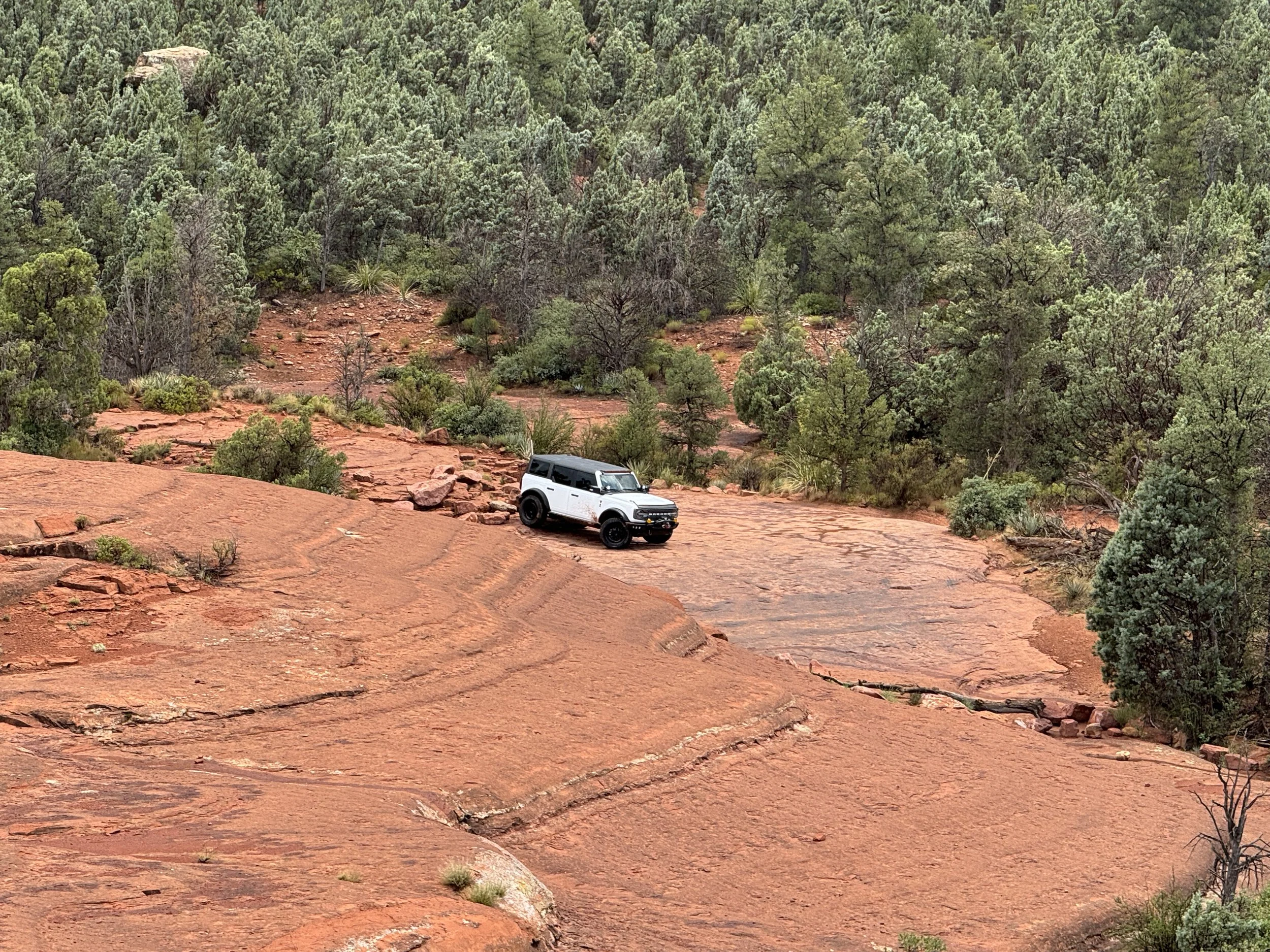
We're going to Sedona
Let's go to SEDONA – Week 3 of the Charity Drive Continues!
Date: Saturday, August 16th
Meet Time: 8:00 AM | Roll Out at 8:15 AM SHARP
Meet Location: McDonald's – Camp Verde (just off I-17)
Coordinates: 34.57547, -111.88330
https://maps.app.goo.gl/EB41mNh8rEmTbhoF9
We’re heading north for cooler weather, red rocks, and some of the most scenic off-roading Arizona has to offer! This is an all-day event so come ready for a full day of fun, dirt, and trail time with the Arizona Broncos crew.
Trail Plan:
We'll start the day with Broken Arrow and follow up with a second trail (TBD — we’ll update the event as soon as it’s locked in). After a full morning of trail time, we’ll wrap up the day with a late lunch at Dellepiane in Sedona.
Trail Rating: Moderate
This is a great run for those with some trail time under their belt. Expect fun obstacles, jaw-dropping views, and plenty of camera-worthy moments.
Vehicle Requirements:
33” tires or larger
Skid plates
Rear locker preferred
What to Bring:
GMRS radio (know how to use it!)
Full tank of fuel
Water + drinks (bring more than you think you’ll need)
Lunch + chairs
Air down kit & compressor
Basic off-road gear
Positive attitude – nobody gets left behind!
Pack it in, pack it out – leave no trace
Reminder: Pinstripes and body damage are always possible on Arizona trails. Arizona Broncos is not responsible for any vehicle damage.
Charity Drive Info:
We’re collecting donations at every group event this season. Please bring:
New, unwrapped toys
Kids’ clothing
Cash donations (suggested value ~$10)
Every donation = 1 raffle ticket for our Christmas Party & Raffle on Dec. 14
(You don’t have to be present to win, but we’d love to see you there!)
All donations benefit:
Maricopa County Sheriff’s Toy Patrol
Arizona Cancer Foundation for Children
OCJ Kids Foster Program
Let’s cruise, crawl, and give back together in beautiful Sedona!

Telegraph Line Trail
We are kicking off week 2 of the CHARITY DRIVE with a great Sunday trail.
Telegraph Line Trail also known as Trail FR42 is a moderate trail that will test your skills if you are newer to the trails but this is NOT a newbie trail for first timers.
Meet up time: 9:00 AM Roll out at 9:30 SHARP
Trail Time (ESTIMATED): +/- 5 hours on dirt depending on number of rigs.
Meet up Coordinates: 33.84527, -111.6481 (Staging area off Bartlett Dam Road)
Google Maps: https://maps.app.goo.gl/ZitWLGLrFby5YEfW8
Trail Type: Moderate
Telegraph Line is a 13.4-mile point-to-point trail that runs one-way only, starting just off Bartlett Dam Road and ending at Horseshoe Lake Road near Horseshoe Dam. The route features a mix of dirt, decomposed granite, and sandy terrain, making for an engaging off-road experience.
Along the way, we will encounter seven named obstacles:
The Gatekeeper
Nosedive
Ben’s Big Rut
Samurai Turn
Airplane
Edge of the Earth
Mini Edge of the Earth
In addition to these, the trail offers a variety of other fun and challenging features that make it a favorite for many. We’ll plan to stop at the lake for lunch and a chance to cool off—don’t forget to pack snacks and water!
A 3 day permit is $10, a 6 month is $60 and an annual pass is $80. Be sure to purchase your pass before to head out and print a copy to show rangers if you are stopped. Click the link here to get your permit https://www.recreation.gov/activitypass/AP22844
Vehicle Requirements:
Any Bronco on 35” tires will have no issues on this trail. If you are on 33’s you might get a little scraping here and there
Group Size:
While there is no cap on the number of rigs at this time, but please make sure and mark yourselves as going if you’re going to head out with us!
The Basics and What to Bring:
Nobody left behind… EVER!
Pack it in, Pack it out.
GMRS Radio (We will pick the channel when we air down). PLEASE, make sure you know how to use your radio before we go!
More water and drinks than you think you will need
Bring a lunch and chairs for when we break
Full tank of fuel
Air down kit and compressor (We can help with this if needed)
Your normal “off-road” kit.
Reminder: There is always a risk of Arizona pinstripes or body damage. Run at your own risk — AZ Broncos is not responsible for vehicle damage.
CHARITY DRIVE DETAILS: At every trailhead through the season—you’ll have a chance to give back. For those who are able, we’re collecting new, unwrapped toys, children’s clothing, and cash donations at all group events. (Our target is a gift worth approximately $10.00.)
As a thank you, you’ll receive a raffle ticket for our Christmas Party & Raffle on December 14th (you do not need to be present to win). Expect some incredible prizes at the raffle!
100% of donations will go directly to the organizations we’re supporting this year..

Ruby's Newbies!
Arizona Broncos is kicking off our holiday charity drive early this year!
At every trailhead—starting with this run and continuing through the season—you’ll have a chance to give back. We’re collecting new, unwrapped toys, children’s clothing, and cash donations at all group events.
As a thank you, you’ll receive a raffle ticket for our Christmas Party & Raffle on December 14th (you do not need to be present to win). Expect some incredible prizes!
100% of donations will go directly to the organizations we’re supporting this year:
• Maricopa County Sheriff’s Toy Patrol
• Arizona Cancer Foundation for Children
• OCJ Kids Foster Program
Let’s make this season one to remember—both on and off the trail.
———————
Meet up time: 9:00 AM (On the trail by 9:30AM)
Trail Time (ESTIMATED): +/- 3 hours on dirt depending on number of rigs.
Meet up Coordinates: 33.62893, -111.56076
Google Link: https://maps.app.goo.gl/CcS5gJLccLanXAhf6
Trail Type: Easy
Permit Required: NO
Are you new to off-roading or just getting to know your Bronco
The Newbies Run is the perfect way to ease into the adventure! This relaxed and beginner-friendly trail ride is guided by experienced members who will walk you through light obstacles and offer helpful tips along the way. We may even have a special sponsor presentation during the run!
You'll get hands-on experience with your Bronco’s features—learning what all the knobs, dials, bells, and whistles do and how they can improve your off-road experience. We'll also go over essential gear to make sure you're prepared for future adventures.
Whether you’re brand new to the trails or just want to build more confidence, this is a great opportunity to explore what your Bronco can do. All Bronco models are welcome, including the Bronco Sport!
Please Note: Like any trail in Arizona, there is always a chance of encountering "Arizona pinstripes" (brush marks or scratches). Arizona Broncos is not responsible for any damage or injury that may occur on the trail.
The Basics and What to Bring
Nobody left behind… EVER!
Pack it in, Pack it out.
GMRS Radio (We will pick the channel when we air down). PLEASE, make sure you know how to use your radio before we go! We also will have some loaner radios available!
More water and drinks than you think you will need
Bring a lunch and chairs for when we break
Full tank of fuel
We will air down but if you don’t have a compressor, we can help out.
Your normal “off-road” kit.

Ruby's' Intermediate Run
Arizona Broncos is kicking off our holiday charity drive early this year!
At every trailhead—starting with this run and continuing through the season—you’ll have a chance to give back. We’re collecting new, unwrapped toys, children’s clothing, and cash donations at all group events.
As a thank you, you’ll receive a raffle ticket for our Christmas Party & Raffle on December 14th (you do not need to be present to win). Expect some incredible prizes!
100% of donations will go directly to the organizations we’re supporting this year:
• Maricopa County Sheriff’s Toy Patrol
• Arizona Cancer Foundation for Children
• OCJ Kids Foster Program
Let’s make this season one to remember—both on and off the trail.
----
• Meet up time: 9:00 AM (On the trail by 9:30AM)
• Trail Time (ESTIMATED): +/- 5 hours on dirt depending on number of rigs.
• Meet up Coordinates: 33.68108, -111.50514 (Upper Sycamore Sugarloaf staging area)
• Google Link: https://maps.app.goo.gl/TisehWJbsXiq8Vm3A
• Trail Type: Moderate
• Permit Required: NO
Step it up with an intermediate run.
This run is geared toward those who may have done our Ruby's Newbies run or have a little bit more off-road experience and looking to take on a slightly more challenging trail. For this adventure, we recommend Broncos equipped with 33” tires or larger—a rear locker will definitely come in handy.
We'll kick things off at the Upper Sycamore Sugarloaf Staging Area and explore the scenic Upper Sycamore trail system. Expect to encounter a few moderate obstacles (with bypasses available), offering a great opportunity to sharpen your skills and experience the value of a good spotter.
Our exact route is still being finalized, but plan for approximately 4 to 5 hours on the trail.
As always, please remember: Any Arizona trail comes with the inherent risk of pinstripes, scrapes, or other vehicle damage. Arizona Broncos assumes no responsibility for any damage or injury that may occur during the run.
The Basics and What to Bring:
• Nobody left behind… EVER!
• Pack it in, Pack it out.
• GMRS Radio (We will pick the channel when we air down). PLEASE, make sure you know how to use your radio before we go!
• More water and drinks than you think you will need
• Bring a lunch and chairs for when we break
• Full tank of fuel
• We will air down but if you don’t have a compressor, we can help out.
• Your normal “off-road” kit

Father's Day Run to the Lake!
Father’s Day Trail Ride to the lake – Sunday, June 15th
What better way to spend Father’s Day than out on the trail with family and friends? Due to growing interest, we’re putting together another relaxed and fun ride to celebrate the day—and everyone’s welcome!
A couple of years ago we did this event and had an absolute blast. It’s time to do it again—play in the lake, catch up with friends, and enjoy a day of adventure and laughs.
Plan for the Day:
We’ll meet at the Four Peaks Upper (Cottonwood) Staging Area, just off Four Peaks Road and Highway 87.
📍 GPS: 33.666764, -111.474032
⏰ Meet at 10:00 AM, air down and be ready to roll out by 10:30 AM.
From there, we’ll cruise through The Rolls OHV area which is about a 1 hour trail ride and make our way down to COVE 2 at Saguaro Lake. We’re not sure how busy the area will be, but either way, it’s sure to be a great time. (We will also send an advance team down to claim our spot like last time)
YOU WILL NEED A TONTO RECREATION PERMIT FOR THIS RUN: LINK HERE
(Note, this is the new Tonto National Forest OHV Permit, not to be confused with the Tonto Pass or State Trust Land permit
What to Bring:
· Lunch for you and your crew
· Plenty of water and drinks
· GMRS radio
· Chairs for lakeside lounging
· Pop Up Shades are welcome if you have one you want to bring
· And of course—bring the kids, dogs, cats, cows, or whatever makes you smile!
This will be an easy ride, suitable for most rigs and drivers.
On the way back:
We’ll split into two groups:
· One group will return the same way we came in.
· The other will take the more challenging route via Pobrecito/Butcher Jones.
Let’s make this Father’s Day one to remember. We hope to see you out there!

Sunrise Run to Four Peaks and Loop
Back in 2023, Steph and I had a wild idea—a Sunrise Run to beat the heat. We didn’t think anyone would show up… but it was a hit. Last year? Same thing. This year, we’re back and adding a twist!
Meet-Up Time: 3:45 AM
Roll-Out Time: 4:15 AM sharp
Trail Time: 4-6 hours depending on which option.
Meet-Up Coordinates: 33.66911, -111.49515 (This is the lower (first) staging area for the 4 Peaks Trail.)
Google Maps Link: https://maps.app.goo.gl/xL9uqDwH6ypp7LTT6
Trail Type: Easy | Bronco Sport friendly
Permit Required: No
What to Expect
Yes—it’s early. Yes—we’ll all groan as we air down and question our life choices. But once we're on the trail chasing the sunrise, all that fades away. The views from the top of 4 Peaks are absolutely stunning, and totally worth it.
We'll stop at the summit viewpoint to take in the sunrise, relax, and enjoy the scenery. From there, you’ll have two route options:
Option 1:
Head back the way we came to the staging area with one of the trail leaders.
Option 2:
Join a leader for the “Super Loop”—continue down the Roosevelt side, cruise past the dam, and head home via the scenic Apache Trail.
Bronco Requirements - All Broncos welcome — including Bronco Sports! Trail is well-maintained and great for all experience levels.
What to Bring
• GMRS Radio (We’ll pick a channel at air-down. Please know how to use it!)
• Plenty of water & drinks — bring more than you think you’ll need
• Snacks & a camp chair for our summit stop
• Full tank of fuel before the trail
• Your standard off-road kit
• Respect the land: Pack it in, pack it out
• And as always — no one gets left behind. Ever.
• We will air down for the comfort of the ride but it is not a requirement for this trail unless it is wet.
Note: Light Arizona pinstripes are possible, but the trail is generally very friendly to your paint. Arizona Broncos is not responsible for any damage during the ride.
We may open this and post in another off-road group as it gets closer. Let’s make this another awesome run!
See you bright and early (emphasis on early)!

Back way to Crown King - Limited Run
Meet up time: 7:30 AM (On the road to the trail by 8:00am)
Trail Time (ESTIMATED): +/- 8 hours on dirt depending on number of rigs. Plan for a day on the trail!
Meet up Coordinates: 33.91049, -112.32468 (This is the air down spot where the pavement ends on Castle Hot Springs Road)
Google Link: https://maps.app.goo.gl/h5HEGSGfoRYbXJePA
Trail Type: Advanced – LIMITED TO 15 VEHICLES
Permit Required: NO
If you've been waiting for the opportunity to run the Back Way to Crown King with the group — this is it! We’re finally putting it together.
This trail is known for its steep climbs, narrow shelf roads, rocky obstacles, historic mining remnants, and epic views. This is NOT a beginner trail. While many of the obstacles offer bypasses, there are a few you’ll need to conquer head-on. For many in the off-road community, this trail is considered a rite of passage.
Trail Limit: We’re capping this run at 15 rigs total (including lead, mid, and tail), which leaves about 12 open spots. First 12 then alternates after that based on when you responded going to the event.
Please note: If you're hesitant about scraping your skid plates or hearing rocks kiss the underside of your Bronco — this probably isn’t the trail for you. Body damage is a real possibility here.
Plan for a Full Day Adventure. With trails like this, we could find ourselves delayed by recovering ourselves or others along the way. If you have somewhere to be, you might be late!
We'll meet at the trailhead where the pavement ends on Castle Hot Springs Road. There, we’ll air down and hold a driver’s meeting. From there, we’ll make our way up the trail to Crown King, link up with the Bronco group coming from the front side, explore the town, grab some fudge, and then cruise down Crown King Road to Bumblebee to air up.
Bronco Requirements:
To join this trail run, your rig must have:
• Minimum 35” tires
• Rear locker (front locker highly recommended)
• Skid plates
• Rock sliders strongly recommended
• Remove large factory running boards or side steps. If you show up with them and they pose a risk, you’ll be asked to remove them before we hit the trail.
The Basics & What to Bring
• No one gets left behind. Ever.
• Pack it in, pack it out.
• GMRS radio (We’ll pick a channel at the air-down spot. Please make sure you know how to use it!)
• Plenty of water & drinks — bring more than you think you’ll need
• Lunch & camp chair for the break
• Full tank of fuel before we start
• Compressor and Air Down gear
• Your usual off-road kit including recovery gear.
As always, expect the possibility of Arizona pinstripes (and in this case, there is a risk of body damage). Arizona Broncos is not responsible for any damage that may occur during the run.
A GPX file will be shared prior to the run for anyone who requests it.
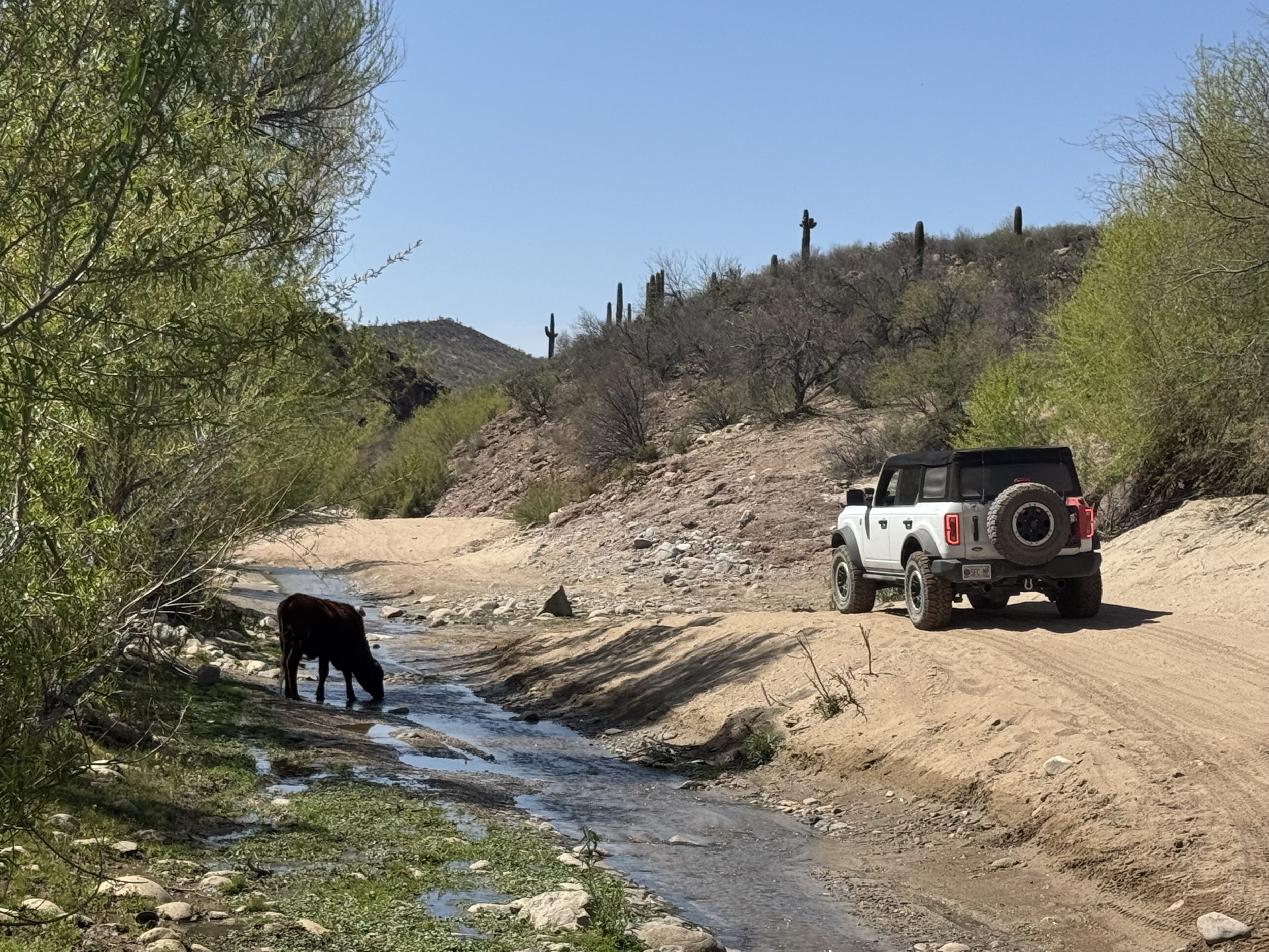
Westside Run! Boulders to Box Canyon Wickenburg
Meet up time: 9:00 AM Trail Time (ESTIMATED): +/- 6 hours on dirt depending on number of rigs. (40 miles start to finish)
Meet up Coordinates: 33.84417, -112.44222 (Boulders OHV Area Trailhead)
Google Maps: https://maps.app.goo.gl/oeWttffeJ975cLpZ6
Trail Type: Moderate to High Moderate
Leaders: TBD
LIMITED RUN TO 15 TOTAL RIGS – Register on Facebook please. Due to the length of the trail and some of the challenges we are limiting this to a 15 rigs total. If we have more than that sign up, we will consider a second group an hour behind the first group.
Westside Run!
This trail will take you from Boulders OHV to Box Canyon in Wickenburg. We will enjoy a little bit of everything from smooth dirt road to rock, lots of hill climbs and descents and some narrow shelf roads. Once we get to Box Canyon there will be plenty of fun water to play in and drive through. The canyon is amazing this time of year.
You will want to have a Bronco (or Jeep/other) on a minimum of 33” tires and at least a steel front skid plate. Some underbelly protection is also advised.
For this trail you WILL need a State Trust Land permit. https://azland.my.salesforce-sites.com/recreationalpermit/ Current cost for a 1 year family permit is $20 . Purchase online here: Please do not try to hop on the run without a permit as they do check from time to time.
We will meet up at the Boulders OHV Area off Carefree Highway at 9am, air down and hit the trail by 9:30am. This is a great staging area with restroom facilities as well.
As always…. On ANY trail in Arizona there is an inherent risk of Arizona pin stripes or scrapes/scratches. This trail is NO exception to the rule. The Arizona Broncos group does not take any responsibility for any damage that may happen along the trail.
What to bring (The basics)
GMRS Radio (We will pick the channel when we air down). PLEASE, make sure you know how to use your radio before we go!
More water and drinks than you think you will need
Bring a lunch and chairs for when we break
Full tank of fuel
You should have all of the tools to air down and air up as well.